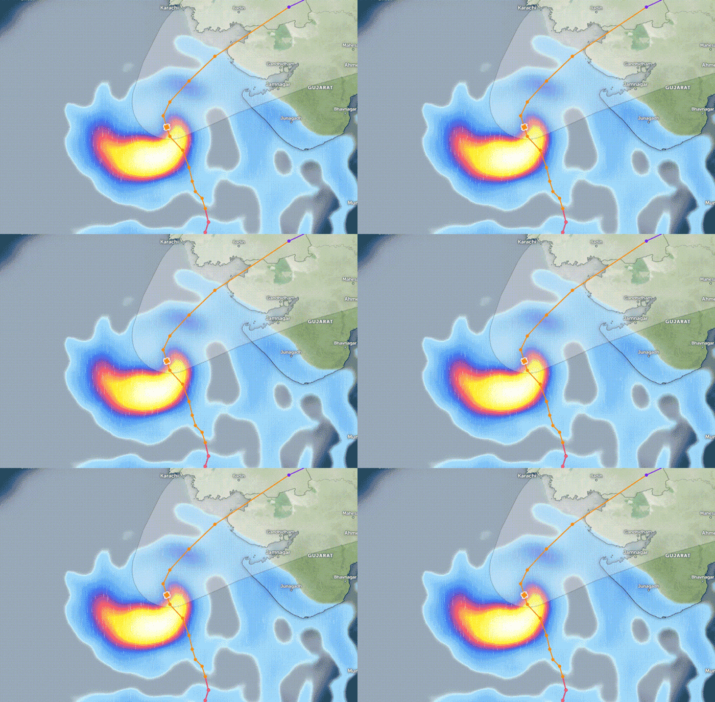
Cyclone Bipar Joy is moving south of Karachi, the effects of which are being felt in the city.
The civilian administration and the military made every effort to prevent the destruction and loss of life caused by the cyclone.
In light of the storm, the evacuation of the coastal belt, including Thatta Badin and Sajawal, has been expedited. The goal is to complete the evacuation of 90,000 people before the storm hits, thereby evacuating the city of Keti Bandar. while Badin and Sajawal are also being evacuated. The victims are transferred to relief camps.
Cyclone Bipar joy's distance from Karachi and Thatta continued to decrease.
Pakistan Army troops from Karachi Cantt, Badin and Hyderabad have been sent to coastal areas to take part in relief operations, while maritime security, guards and elected officials are evacuating people off the coast to safer places.
According to the Meteorological Department, Bipar Joy is moving north and northwest for six hours, while the cyclone is 410 km south of Karachi and 400 km south of Thatta.
The wind speed in the center reaches 180 km/h.
According to the Department of Meteorology, the extremely strong storm approached the coastal areas in the northeast, the wind speed in the center of the storm is 150 to 160 km/h, while the wind gusts reach a speed of 180 km/h. in the middle of the storm h. IS
According to the meteorological department, the sea around the center of the system is very rough and waves rise up to 30 feet around the center.
The effects of the cyclone are also being felt, with heavy traffic jams in Karachi, Thatta, Badin and other areas, while water has reached roads in Karachi's coastal town of Chashma Goth.
 |
The image shows in which area it will rain on June 13 at 4:30 p.m. due to Cyclone Bipar Joy. (Image source: Geo News) |
Sea level rise in coastal areas
Sea water levels have risen in coastal areas of Karachi due to possible cyclone Bipar Joy.
With the continued rise in seawater in Chashma Goth, the water has reached the street side of Chashma Goth and residents on the other side have not yet evacuated their homes.
Speaking to Geo News, a fisherman said that as the water levels rose at Lagigoth Pier, part of the aircraft became submerged during the evening hours.
Rainfall is expected in Thatta, Sajawal, Badin, Tharpakar and Umarkot from today till June 17.
According to the Meteorological Department, rainfall is expected in Thatta, Sajawal, Badin, Tharpakar and Umarkot from today till June 17, while the wind speed may reach 80-100 and sometimes even 120 kmph.
Besides, heavy rain with wind and thunder is expected in Hyderabad, Tando Muhammad Khan, Tando Allahyar and Mirpurkhas between 14th and 16th, while dusty winds and heavy rain are also expected in Hub and Lasbela from 14th to 16th June.
According to the Met Office, strong winds can damage weak buildings and mud houses. During the storm, waves in Kati Bandar and surrounding areas may reach 8 to 12 feet, while waves on the Sindh coast may reach 2 to 2.5 feet. Similarly, waves on the coast of Balochistan can be up to 2 meters high.


